Using External Map Services
QGIS is a standard compliant application, thus, many external mapping data and services can be “consumed” within the application. The most popular external service for map data is Web Map Service (WMS), this is a standard protocol for consuming georeferenced data over the web.
In this exercise, we will use several web-based mapping services and integrate them in your QGIS project.
Note
You need a working Internet connection in this section.
Loading WMS
1. To add WMS layer, click Layer ‣  Add WMS Layer. A new window will appear as
Add Layer(s) from a Server.
Add WMS Layer. A new window will appear as
Add Layer(s) from a Server.

2. To add a new WMS server, click New. In the Create a new WMS connection window, type irs.gis-lab.info in the Name field. In the : guilabel:URL field, type (the value below should be in a single line):
http://irs.gis-lab.info/
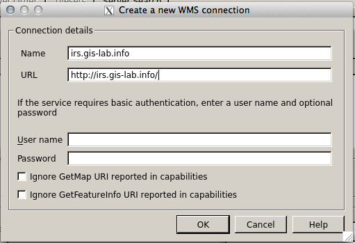
Warning
External WMS is not always available, hence, reliability is not guaranteed.
3. Click OK. A new WMS service is now available.
4. Back to the Add Layer(s) from a Server window, select irs.gis-lab.info –> Connect. The list of available layers will be shown. Select the landsat layer and click Add. QGIS will start downloading the map from the WMS server (this will take some time depending on your connection speed and the current load from the server).
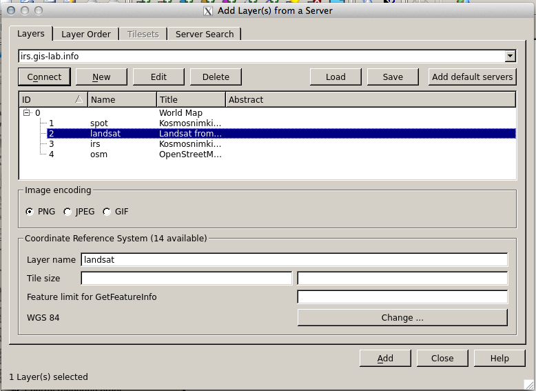
5. Once downloaded, Close the Add Layer(s) from a Server window. A new layer will be displayed in your Map Canvas.

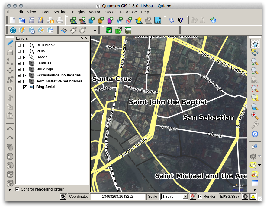
6. Zoom the map to larger area to see the Landsat layer. Drag the WMS layer below the points and line layers.
Using the Openlayers plugin
Another way to display external map services is through the Openlayers plugin. The plugin allows you to use several map tiles available from OpenStreetMap, Google Maps, Bing and others.
- Zoom in to a small area.
2. In the Menu, select Plugins ‣
Openlayers plugin ‣
 Add Bing Aerial layer. A new layer will appear showing
the Bing Aerial layer, zoom in closer to view the higher resolution images.
Add Bing Aerial layer. A new layer will appear showing
the Bing Aerial layer, zoom in closer to view the higher resolution images.
3. Load the other layers available in the Openlayers plugin.
Note
The Openlayers plugin uses a custom CRS. You can see this in the bottom-right corner of the Status bar. The CRS is labeled as EPSG:3857 or the Google Mercator projection.
Warning
Each time you use an external web service such as a WMS or the layers available in the Openlayers plugin, make sure to check the Terms of Use of each service. Most web services have usage restrictions. For example, Google does not allow saving the imagery for offline use.